Loading...
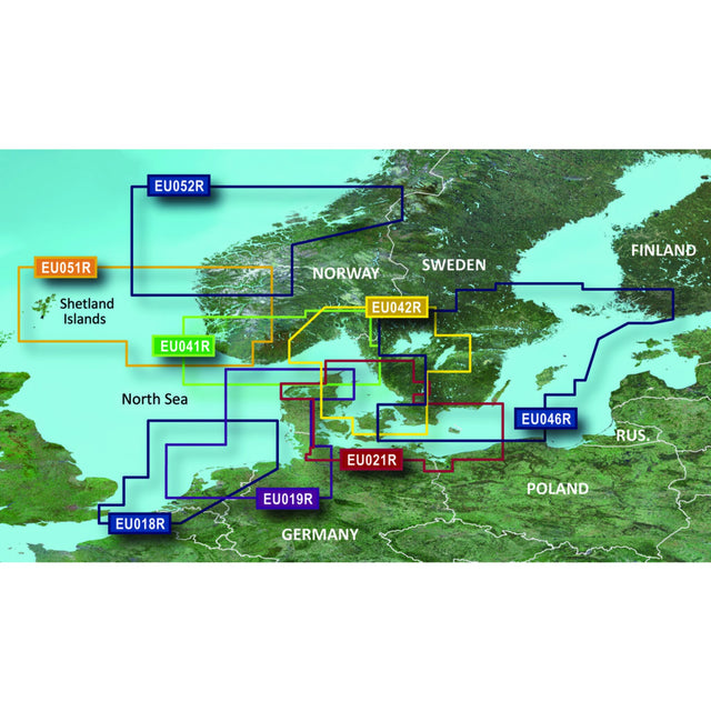
G3 REGULAR EU018R - Westliche Nordsee
Sold out
Regular price
€164,00
-0%
Unit price
/
Unavailable
GARMIN Nautical Chart G3 VISION Cartography Western North Sea, Coastal Sea Charts, Depth Shading Range 10 Depth Ranges is backordered and will ship as soon as it is back in stock.
Couldn't load pickup availability
30 Tage Rückgaberecht

Description
Description
Garmin's state-of-the-art Blue-Chart G3 VISION cartography offers excellent coverage, clarity, and detail with updated coastal charts. Water structure representation is accurate to within 1 foot, with depth shading for up to 10 depth ranges. Shallow water area highlighting allows you to mark custom depth ranges.
This GARMIN G3 EU018R map shows the western North Sea from Spiekeroog through the Netherlands and Belgium to Calais in France.
Product features
Product features
SKU
416712
EAN
753759091743