1
of
2
Loading...
C-Map Max-4D
Sold out
Sold out
Sold out
Regular price
€249,00
-0%
Unit price
/
Unavailable
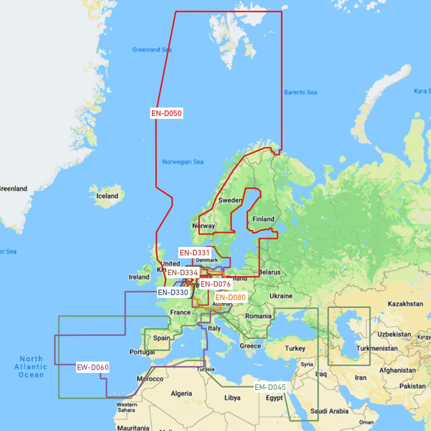
C-MAP Max-4D electronic navigation chart, 2D/3D map view with high-resolution satellite imagery, perfect for boaters, sailors and anglers - Southwest European coasts, inland Belgium and the Rhine, Northern and Central Europe - Northern and Central Europe is backordered and will ship as soon as it is back in stock.
Couldn't load pickup availability
30 Tage Rückgaberecht

Description
Description
C-MAP 4D is the latest product within C-MAP's electronic navigation technology. Vector map data is combined here with dynamic map grids. Also added is the ability for maps to be mapped in 2D or 3D with high resolution satellite imagery. Perfect for all boaters, sailors and anglers!
There is also the option to add new data segments and features as needed.
Product features
Product features
SKU
411131
EAN
411131