Loading...
C-MAP Electronic Navigation Chart Belgium Inland Waters and Rhine, Boat and Sailing Charts, 2D/3D with Satellite Images
Sold out
Regular price
€164,99
-0%
Unit price
/
Unavailable
C-MAP Electronic Navigation Chart Belgium Inland Waters and Rhine, Boat and Sailing Charts, 2D/3D with Satellite Images is backordered and will ship as soon as it is back in stock.
Couldn't load pickup availability
30 Tage Rückgaberecht

Description
Description
C-MAP 4D is the latest product in C-MAP's electronic navigation technology. It combines vector chart data with dynamic map grids.
Additionally, it offers the ability to display maps in 2D or 3D with high-resolution satellite imagery. Perfect for all boaters, sailors, and anglers! There's also the option to add new data segments and features as needed.
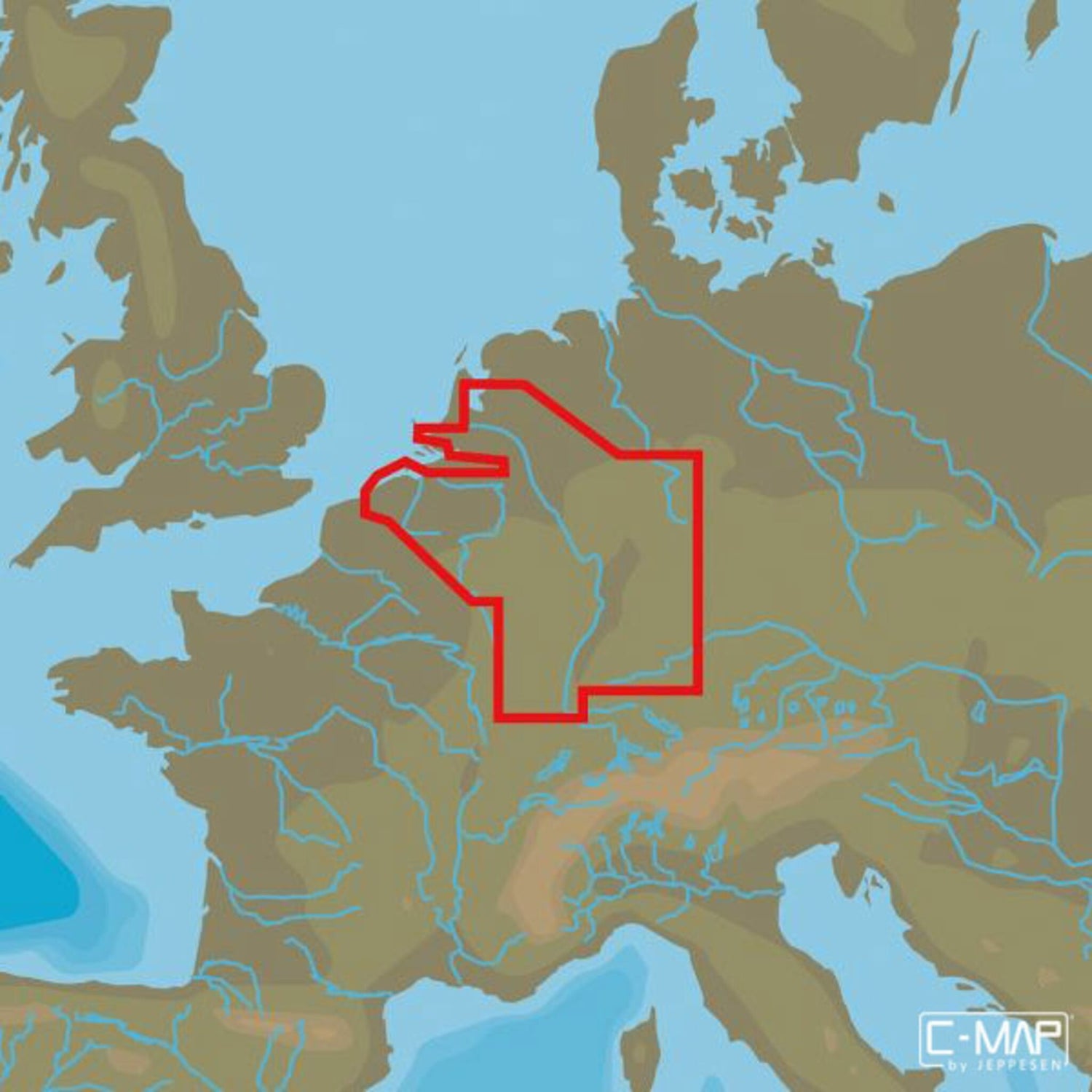
The C-MAP MAX 4D EN-076 BELGIUM INLAND AND RIVER RHEIN chart material depicts the Belgian inland waters and the Rhine.
- Card format: MSD/SD.
- Compatible chartplotters: Furuno, Raymarine and others.
Product features
Product features
SKU
410822
EAN
410822
