C-MAP nautical chart High-resolution 2D and 3D display, navigation chart, expandable with new data segments
C-MAP nautical chart High-resolution 2D and 3D display, navigation chart, expandable with new data segments is backordered and will ship as soon as it is back in stock.
Couldn't load pickup availability

Description
Description
C-MAP 4D is the latest product in C-MAP's electronic navigation technology. It combines vector chart data with dynamic chart grids. It also offers the ability to display charts in 2D or 3D with high-resolution satellite imagery. Perfect for all boaters, sailors, and anglers!
There is also the option to add new data segments and functions if needed.
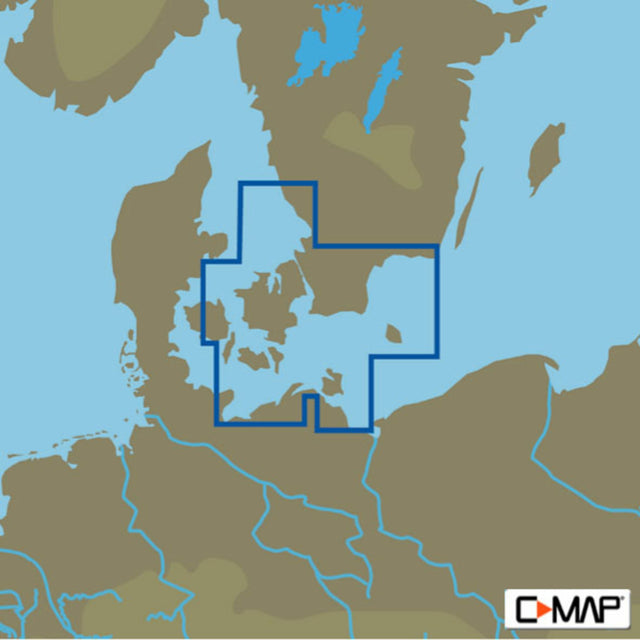
The C-MAP MAX D EN-D331 VARBERG TO LUBECK chart material covers the Swedish coastal area from Varberg to Karlskrona, as well as the Danish islands of Bornholm, Zealand, Lolland, eastern Funen up to and including Lübeck.
- Card format: MSD/SD.
- Compatible chartplotters: Furuno, Raymarine and many others.
Product features
Product features
Manufacturer information
Manufacturer information
Hersteller: BRUNSWICK MARINE IN EMEA INC. Parc
Adresse: Industriel de Petit-Rechain Avenue Mercury 8 , 4800 Verviers , BE