GARMIN Blue-Chart G3 VISION cartography Ionian Sea, nautical charts plotter, 3D views & high-resolution satellite images
GARMIN Blue-Chart G3 VISION cartography Ionian Sea, nautical charts plotter, 3D views & high-resolution satellite images is backordered and will ship as soon as it is back in stock.
Couldn't load pickup availability

Description
Description
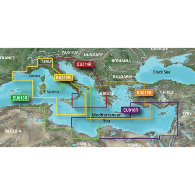
Garmin's state-of-the-art Blue-Chart G3 VISION cartography offers excellent coverage, clarity, and detail with updated coastal charts. Water feature representation is accurate to within 1 foot, with depth shading for up to 10 depth ranges. Shallow water area highlighting allows you to mark custom depth ranges. Garmin's Blue-Chart G3 Vision cartography offers unique 3D views and high-resolution satellite imagery. MarinerEye and FishEye provide 3D representations above and below the waterline.
Garmin G3 VISION REGULAR VEU015R maps the Ionian Sea from Brindisi, the Aegean Sea with islands and the Sea of Marmara up to Istanbul.