C-MAP MAX-N+ Southwest European Coasts MSD/SD nautical charts, high-resolution bathymetry for sailors and anglers, dynamic raster charts
C-MAP MAX-N+ Southwest European Coasts MSD/SD nautical charts, high-resolution bathymetry for sailors and anglers, dynamic raster charts is backordered and will ship as soon as it is back in stock.
Couldn't load pickup availability

Description
Description
Like all C-MAP cartography products, the C-MAP MAX-N+ chart material offers outstanding features for both sailors and anglers. C-MAP MAX-N+ provides a standard nautical chart view in the form of dynamic raster charts. It also offers options for accessing other important and helpful information. Thanks to high-resolution bathymetry charts (also called HRB) and sportfishing data, not only sailors but especially anglers will be impressed by this powerful technology! The tide and current display is particularly helpful for trip planning.
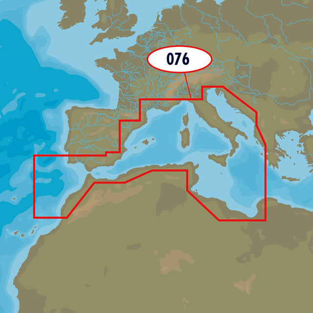
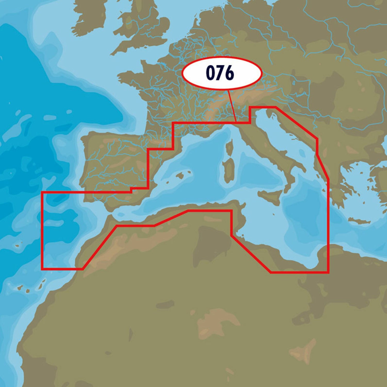
The C-MAP MAX-N+ EM-Y076 Southwest European Coasts chart material covers the southwestern European coasts.
- Card format: MSD / SD.
- Compatible chartplotters: Lowrance, Simrad, B&G.