Loading...
C-MAP navigation chart 4D vector maps 2D/3D, nautical charts, high-resolution satellite images
Sold out
Regular price
€0,00
-0%
Unit price
/
Unavailable
C-MAP navigation chart 4D vector maps 2D/3D, nautical charts, high-resolution satellite images is backordered and will ship as soon as it is back in stock.
Couldn't load pickup availability
30 Tage Rückgaberecht

Description
Description
C-MAP 4D is the latest product in C-MAP's electronic navigation technology. It combines vector chart data with dynamic chart grids. It also offers the ability to display charts in 2D or 3D with high-resolution satellite imagery. Perfect for all boaters, sailors, and anglers!
There is also the option to add new data segments and functions if needed.
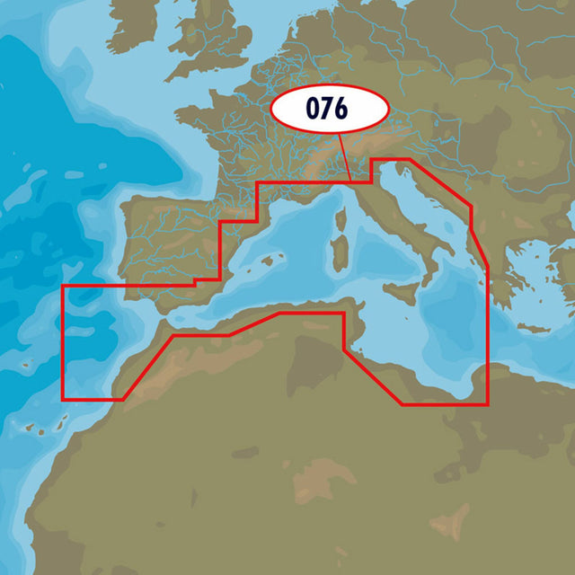
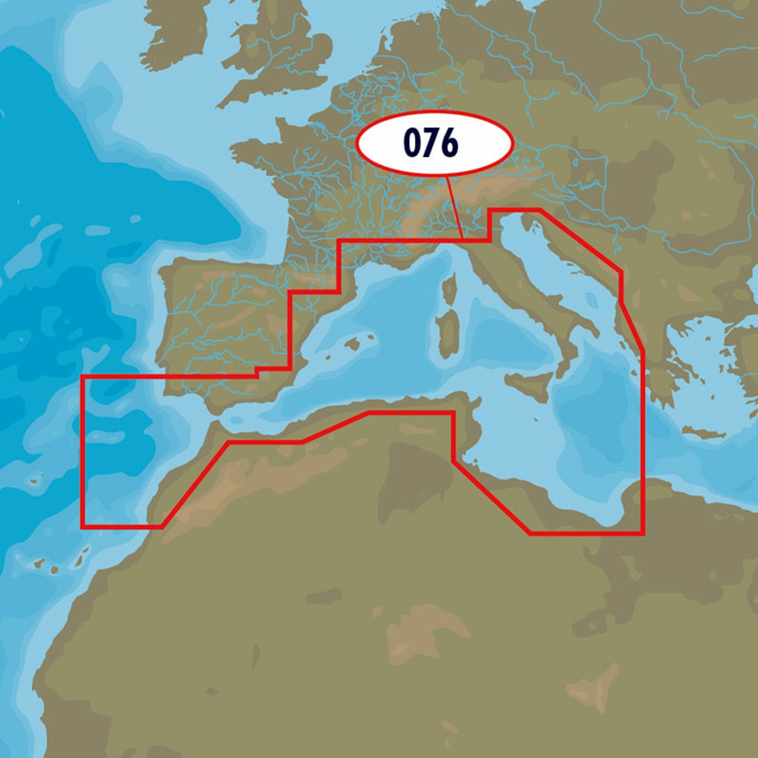
The C-MAP 4D EM-D076 Southwest European Coasts chart covers the Western European coasts.
- Card format: MSD / SD.
- Compatible chartplotters: Furuno, Raymarine and many others.
Product features
Product features
SKU
416824
EAN
416824