Garmin Cartography G3 Vision Germany Inland Waters, Nautical Charts, 3D Views & Satellite Images
Garmin Cartography G3 Vision Germany Inland Waters, Nautical Charts, 3D Views & Satellite Images is backordered and will ship as soon as it is back in stock.
Couldn't load pickup availability

Description
Description
Garmin's state-of-the-art Blue-Chart G3 Vision cartography offers excellent coverage, clarity, and detail with updated coastal charts. Water feature representation is accurate to within 1 foot, with depth shading for up to 10 depth ranges. Shallow water area highlighting allows you to mark custom depth ranges. Garmin's Blue-Chart G3 Vision cartography offers unique 3D views and high-resolution satellite imagery. MarinerEye and FishEye provide 3D representations above and below the waterline.
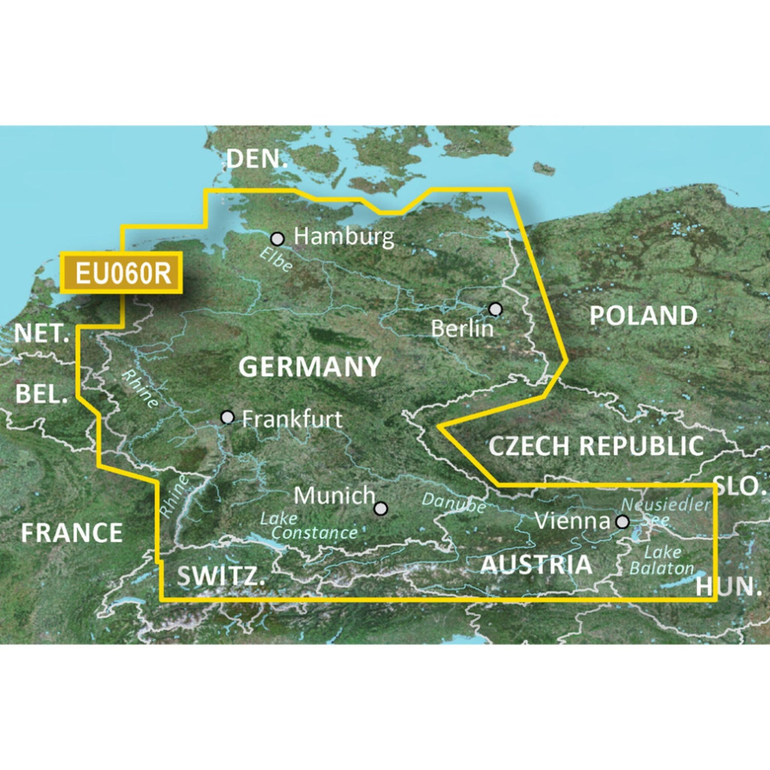
Garmin G3 vision regular VEU060R maps the inland waters of Germany.
